International Parks
  • Explore
  • Map
  • Ratings
  • Review
  • Wiki
  • Suggest a Park
  • About
Log In
  1. Home
  2. Myanmar Parks
  3. Kyaikhtiyo

Quick Actions

Park SummaryView on MapMyanmar WikiWiki HomeWrite ReviewReport an Issue

Nearby Parks

Kelatha28 kmKahilu45 kmMoeyungyi Wetland54 kmSalawin99 kmSalawin108 km

Platform Stats

23,798Total Parks
217Countries & Territories
Support Us
Kyaikhtiyo in Mon, Myanmar

Kyaikhtiyo

Myanmar, Mon

  1. Home
  2. Myanmar Parks
  3. Kyaikhtiyo

Kyaikhtiyo

LocationMyanmar, Mon
RegionMon
TypeWildlife Sanctuary
Coordinates17.4667°, 97.0833° (show on the map)
Established2001
Area156 km²
Nearest CityKyaikto (15 km)
Major CityMawlamyine (60 km)
See all parks in Myanmar →

About Kyaikhtiyo

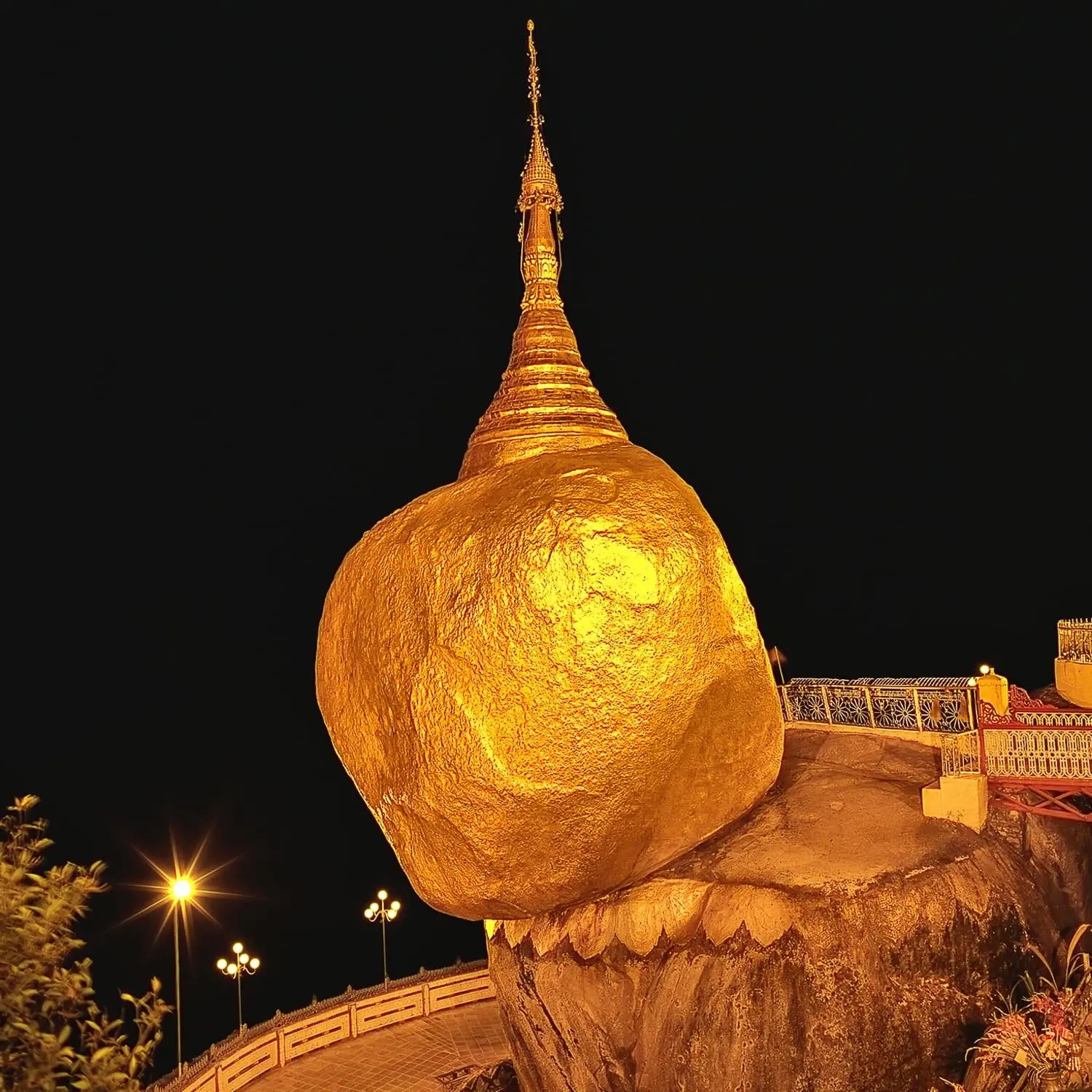
A 156 km² protected area of evergreen and mixed deciduous forest (elevation 50–1,090 m) in Kyaikto Township, Mon State, established in 2001 to conserve biodiversity around the famous Kyaiktiyo (Golden Rock) Pagoda. Managed by the Myanmar Forest Department.

Visitor Ratings

Not yet rated. Been here? Your review gives this park its first scores.

Write a review

Photos

2 photos
Kyaikhtiyo in Mon, Myanmar (photo 1 of 2)
Kyaikhtiyo in Mon, Myanmar (photo 2 of 2)

International Parks

Helping nature enthusiasts discover and explore the world's most remarkable protected areas.

© 2026 International Parks. All rights reserved.

Navigation

  • Home
  • Explore Parks
  • Interactive Park Map
  • Park Ratings & Rankings
  • Park Wiki
  • Parks by Country

Resources

  • About Us
  • US National Park Seasons
  • Privacy & Terms
  • Copyright & Takedown

Account

  • My Profile
  • Suggest a Park
  • Write a Review
  • Log In
  • Sign Up

Connect

Support This Project

Contact Us

internationalparksbusiness@gmail.com

Explore by Country

  • United States
  • Canada
  • Australia
  • United Kingdom
  • Japan
  • Brazil
  • India
  • France
  • Germany
  • Italy
  • Spain
  • Thailand
  • All countries