International Parks
  • Explore
  • Map
  • Ratings
  • Review
  • Wiki
  • Suggest a Park
  • About
Log In
  1. Home
  2. South Korea Parks
  3. Mudeungsan

Quick Actions

Park SummaryView on MapSouth Korea WikiWiki HomeWrite ReviewReport an Issue

Nearby Parks

Jogyesan21 kmGangcheonsan28 kmNaejangsan33 kmUngok33 kmBulgapsan40 km

Platform Stats

23,798Total Parks
217Countries & Territories
Support Us
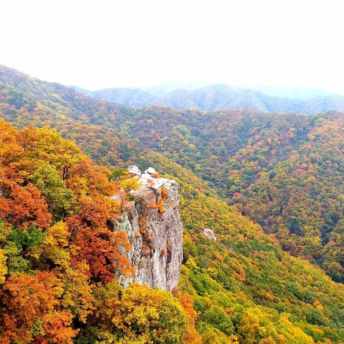
Mudeungsan in South Jeolla, South Korea

Mudeungsan

South Korea, South Jeolla

  1. Home
  2. South Korea Parks
  3. Mudeungsan

Mudeungsan

LocationSouth Korea, South Jeolla
RegionSouth Jeolla
TypeNational Park
Coordinates35.144°, 126.989° (show on the map)
Established2012
Area75 km²
Nearest CityGwangju (10 km)
See all parks in South Korea →
Contents
  1. Park Overview
    1. About Mudeungsan
    2. Wildlife Ecosystems
    3. Flora Ecosystems
    4. Geology
    5. Climate and Weather
    6. Human History
    7. Park History
    8. Major Trails and Attractions
    9. Visitor Facilities and Travel
    10. Conservation and Sustainability
  2. Visitor Information
    1. Visitor Ratings
    2. Photos
  3. Sources

About Mudeungsan

Mudeungsan National Park spans Buk District of Gwangju, Hwasun County and Damyang County, covering 75.425 km2. It was designated a national park on 31 December 2012, and its highest summit is Cheonwangbong at 1,187 m[1].

Wildlife Ecosystems

Otters, wildcats, buzzards and Mandarin ducks are found in the park and designated as endangered[1].

Flora Ecosystems

The Korean article records 2,296 species in total in the park[2].

Geology

Vertically jointed rock formations rise around the summit, including Seoseokdae, Ipseokdae and Gyubong, protected as Natural Monument No. 465[2][1].

Climate and Weather

The average annual temperature is 13.2 C, about 5 C below downtown Gwangju, with about 1,500 mm of rain a year and 53 clear days[1].

Human History

The mountain was called Muak or Mujinak, then Seoseok mountain in Goryeo, and Mudeungsan after Buddhism arrived[1]. Silla-era temples include Wonhyosa, Jeungsimsa and Gyubongam[2].

Park History

It was a provincial park from 22 May 1972, and Gwangju petitioned for national status in 2010. It became a national park on 31 December 2012, with offices installed on 4 March 2013[1]. A military base on the summit since 1966 limited access, and Inwang and Jiwang peaks opened in 2011[2].

Major Trails and Attractions

The 51.8 km Mudeul-gil loop circles the mountain, and the Old Trail Course 2 runs 4.12 km from Wonhyosa to Seoseokdae in about 2 hours. Seoseokdae, at about 1,100 m, is the highest point hikers reach without a permit[2][1].

Visitor Facilities and Travel

The park has a main office and an eastern office[2]. It lies next to Gwangju, about 10 km from the city.

Conservation and Sustainability

The park contains 61 scenic resource sites and 17 designated cultural assets. The Gwangju Lake and Gasa cultural zone were excluded from the park[2].

Visitor Ratings

Not yet rated. Been here? Your review gives this park its first scores.

Write a review

Photos

1 photo
Mudeungsan in South Jeolla, South Korea

Sources

  1. en.wikipedia.org/wiki/Mudeungsan (opens in a new tab)
  2. ko.wikipedia.org/wiki/무등산국립공원 (opens in a new tab)

International Parks

Helping nature enthusiasts discover and explore the world's most remarkable protected areas.

© 2026 International Parks. All rights reserved.

Navigation

  • Home
  • Explore Parks
  • Interactive Park Map
  • Park Ratings & Rankings
  • Park Wiki
  • Parks by Country

Resources

  • About Us
  • US National Park Seasons
  • Privacy & Terms
  • Copyright & Takedown

Account

  • My Profile
  • Suggest a Park
  • Write a Review
  • Log In
  • Sign Up

Connect

Support This Project

Contact Us

internationalparksbusiness@gmail.com

Explore by Country

  • United States
  • Canada
  • Australia
  • United Kingdom
  • Japan
  • Brazil
  • India
  • France
  • Germany
  • Italy
  • Spain
  • Thailand
  • All countries