International Parks
  • Explore
  • Map
  • Ratings
  • Review
  • Wiki
  • Suggest a Park
  • About
Log In
  1. Home
  2. South Korea Parks
  3. Bukhansan

Quick Actions

Park SummaryView on MapSouth Korea WikiWiki HomeWrite ReviewReport an Issue

Nearby Parks

Cheonmasan21 kmNamhansanseong28 kmSurisan32 kmSongdo Tidal Flat43 kmYeoninsan43 km

Platform Stats

23,798Total Parks
217Countries & Territories
Support Us
Bukhansan in Gyeonggi, South Korea

Bukhansan

South Korea, Gyeonggi

  1. Home
  2. South Korea Parks
  3. Bukhansan

Bukhansan

LocationSouth Korea, Gyeonggi
RegionGyeonggi
TypeNational Park
Coordinates37.675°, 126.982° (show on the map)
Established1983
Area80 km²
Nearest CitySeoul
See all parks in South Korea →
Contents
  1. Park Overview
    1. About Bukhansan
    2. Wildlife Ecosystems
    3. Flora Ecosystems
    4. Geology
    5. Climate and Weather
    6. Human History
    7. Park History
    8. Major Trails and Attractions
    9. Visitor Facilities and Travel
    10. Conservation and Sustainability
  2. Visitor Information
    1. Visitor Ratings
    2. Photos
  3. Sources

About Bukhansan

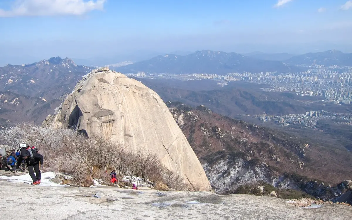
Bukhansan National Park lies on the northern edge of Seoul and into Gyeonggi Province, with about 79.92 km2 and peaks of granite. It was established on 2 April 1983. The name means "mountains north of the Han River", and Baegundae is the highest peak at 836.5 m[1].

Wildlife Ecosystems

About 1,300 species of plants and animals inhabit the park[2].

Flora Ecosystems

Forested slopes and azaleas are mentioned for the park[1].

Geology

The mountain is mainly Daebo granite, a Jurassic intrusive rock dated to about 160 million years ago[2].

Climate and Weather

Bukhansan has a continental monsoon climate typical of Seoul, with hot humid summers and cold dry winters.

Human History

The area was originally Mahan territory. Baekje called it Hansan, Goguryeo set up Bukhansan-gun in 475 and Silla took it in 553, erecting the Bukhansan Shilla Jinheung King Stele. The three main peaks were known as Samgaksan, "three horned mountains"[2][1].

Park History

Bukhansan was designated South Korea's 15th national park on 2 April 1983 and its scenic site status followed in 2003[2]. It is described as the most visited national park per unit area[2].

Major Trails and Attractions

The Bukhansanseong fortress was built in 1711 with a 9.5 km wall and 14 gates, plus 13 temples inside. Insubong (810.5 m) and Mangyeongdae are other major peaks. The Dulle-gil trail is 70 km in 21 sections[1][2].

Visitor Facilities and Travel

The park lies on the northern edge of Seoul. Temples such as Jungheungsa, Hwagyesa, Seungasa and Jingwansa lie within it[2].

Conservation and Sustainability

Some trails close on a rotating basis to protect the environment from heavy use by hikers[1].

Visitor Ratings

Not yet rated. Been here? Your review gives this park its first scores.

Write a review

Photos

1 photo
Bukhansan in Gyeonggi, South Korea

Sources

  1. en.wikipedia.org/wiki/Bukhansan_National_Park (opens in a new tab)
  2. ko.wikipedia.org/wiki/북한산국립공원 (opens in a new tab)

International Parks

Helping nature enthusiasts discover and explore the world's most remarkable protected areas.

© 2026 International Parks. All rights reserved.

Navigation

  • Home
  • Explore Parks
  • Interactive Park Map
  • Park Ratings & Rankings
  • Park Wiki
  • Parks by Country

Resources

  • About Us
  • US National Park Seasons
  • Privacy & Terms
  • Copyright & Takedown

Account

  • My Profile
  • Suggest a Park
  • Write a Review
  • Log In
  • Sign Up

Connect

Support This Project

Contact Us

internationalparksbusiness@gmail.com

Explore by Country

  • United States
  • Canada
  • Australia
  • United Kingdom
  • Japan
  • Brazil
  • India
  • France
  • Germany
  • Italy
  • Spain
  • Thailand
  • All countries