International Parks
  • Explore
  • Map
  • Ratings
  • Review
  • Wiki
  • Suggest a Park
  • About
Log In
  1. Home
  2. Myanmar Parks
  3. Hukaung Valley

Quick Actions

Park SummaryView on MapMyanmar WikiWiki HomeWrite ReviewReport an Issue

Nearby Parks

Inkhain Bum64 kmBumhpa Bum83 kmNamdapha118 kmPidaung122 kmKamlang141 km

Platform Stats

23,798Total Parks
217Countries & Territories
Support Us
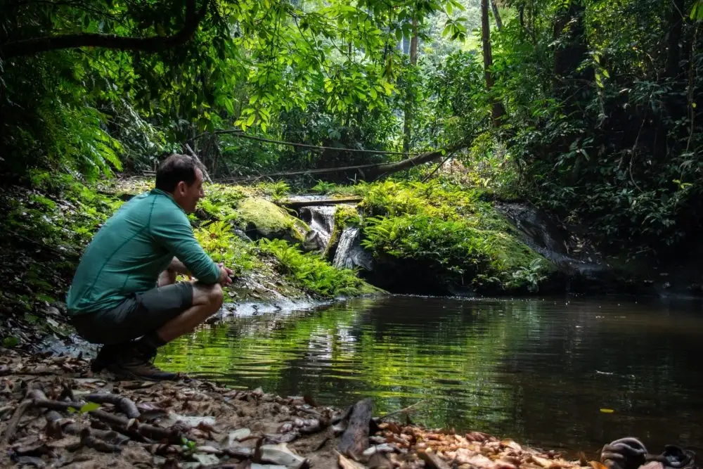
Hukaung Valley in Kachin, Myanmar

Hukaung Valley

Myanmar, Kachin

  1. Home
  2. Myanmar Parks
  3. Hukaung Valley

Hukaung Valley

LocationMyanmar, Kachin
RegionKachin
TypeWildlife Sanctuary
Coordinates26.4383°, 96.5589° (show on the map)
Established2004
Area17,374 km²
Nearest CityTanai (20 km)
Major CityMyitkyina (170 km)
See all parks in Myanmar →
Contents
  1. Park Overview
    1. About Hukaung Valley
    2. Wildlife Ecosystems
    3. Flora Ecosystems
    4. Geology
    5. Human History
    6. Park History
    7. Conservation and Sustainability
  2. Visitor Information
    1. Visitor Ratings
    2. Photos
  3. Sources

About Hukaung Valley

Hukaung Valley Wildlife Sanctuary covers about 17,374 km² in the Hukawng Valley of northern Myanmar, in Kachin State and Sagaing Region, with Tanai as the nearest town. It is managed by the Forest Department as IUCN Category IV[1].

Wildlife Ecosystems

Camera-trap surveys from 2001 to 2011 recorded tiger, leopard, clouded leopard, Asian golden cat, marbled cat and leopard cat, along with binturong, several civet species, hog badger, yellow-throated marten and spotted linsang. The area is also an Important Bird Area[1]. Conservationists say it is home to Asian elephants and about 370 bird species, including the critically endangered rufous-necked hornbill[2].

Flora Ecosystems

The sanctuary contains evergreen forest and mixed deciduous forest[1]. It protects some of the last large areas of closed forest in the Indo-Pacific region, along with wetlands[2].

Geology

Elevation runs from about 125 m on the valley floor to 3,435 m in the surrounding mountains[1].

Human History

Conservationists worked with local ethnic groups, recent settlers and local businesses, and several townships agreed to become multi-use areas within the reserve[2].

Park History

The first biological expedition took place in 1999, led by Alan Rabinowitz with Forest Department and Wildlife Conservation Society staff. The sanctuary was established in 2004 at about 6,371 km² in Tanaing Township and extended to its present size in 2010, reaching into Kamaing, Nanyun and Kamti townships[1]. Officials announced the tiger reserve on 3 August 2010, billed as the world's largest[2].

Conservation and Sustainability

Illegal hunting of tigers and their prey is described as the main threat[2]. Gold mining has taken over more than 200,000 acres of land in the Hukawng Valley[1].

Visitor Ratings

Not yet rated. Been here? Your review gives this park its first scores.

Write a review

Photos

1 photo
Hukaung Valley in Kachin, Myanmar

Sources

  1. en.wikipedia.org/wiki/Hukaung_Valley_Wildlife_Sanctuary (opens in a new tab)
  2. newsroom.wcs.org/News-Releases/articleType/ArticleView/articleId/5354/Myanmar-O… (opens in a new tab)

International Parks

Helping nature enthusiasts discover and explore the world's most remarkable protected areas.

© 2026 International Parks. All rights reserved.

Navigation

  • Home
  • Explore Parks
  • Interactive Park Map
  • Park Ratings & Rankings
  • Park Wiki
  • Parks by Country

Resources

  • About Us
  • US National Park Seasons
  • Privacy & Terms
  • Copyright & Takedown

Account

  • My Profile
  • Suggest a Park
  • Write a Review
  • Log In
  • Sign Up

Connect

Support This Project

Contact Us

internationalparksbusiness@gmail.com

Explore by Country

  • United States
  • Canada
  • Australia
  • United Kingdom
  • Japan
  • Brazil
  • India
  • France
  • Germany
  • Italy
  • Spain
  • Thailand
  • All countries