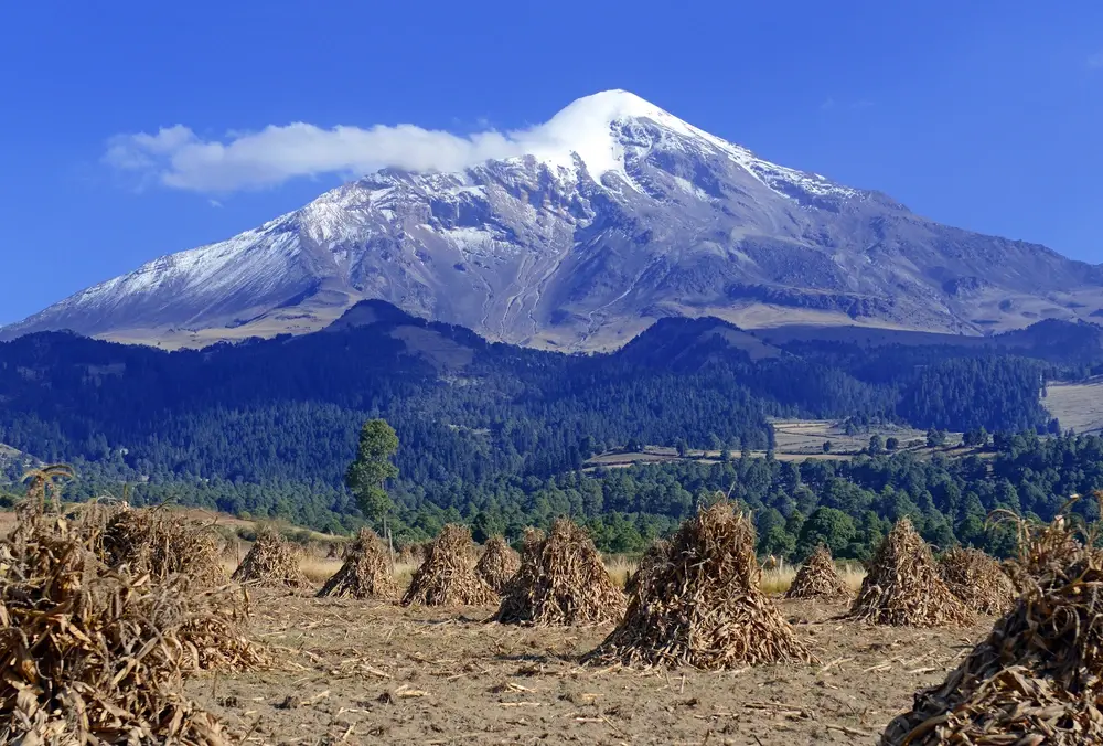
Pico de Orizaba
Mexico, Veracruz, Puebla
About Pico de Orizaba
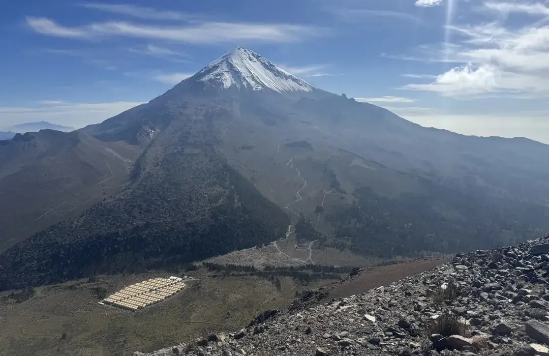
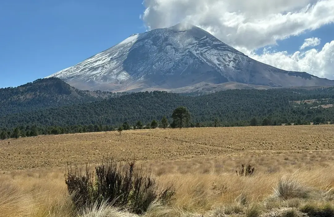
Pico de Orizaba National Park protects 19,750 hectares surrounding Mexico's highest peak and North America's third-highest mountain at 5,636 meters above sea level.[1] The park straddles the states of Veracruz and Puebla, encompassing the stratovolcano known in Nahuatl as Citlaltépetl (Star Mountain) and its surrounding alpine and subalpine ecosystems. Established in January 1937, the park ranges from temperate forests at lower elevations through alpine meadows to the snow and ice-covered summit, creating dramatic ecological gradients.[1] The volcano remains dormant but not extinct, with its last eruption occurring in 1846, and its glaciers represent some of Mexico's last remaining permanent ice.
Wildlife Ecosystems
Wildlife on Pico de Orizaba varies by elevation and habitat zone. Lower elevations host diverse species including white-tailed deer, wild turkey, and various rodents. The mountain's mid-elevations are home to unique species like the volcano rabbit (teporingo), an endangered species endemic to Mexican volcanoes. Raptors such as the red-tailed hawk and American kestrel can be observed soaring above the slopes. At higher elevations, wildlife becomes scarcer, though hardy species like the rock wren and American pipit can still be found. The mountain's diverse ecosystems provide critical habitat for numerous migratory bird species.
Flora Ecosystems
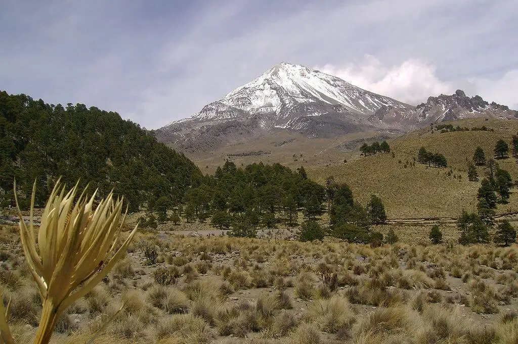
The mountain's vegetation varies dramatically with altitude, creating distinct ecological zones. The lower slopes (2,000–3,000 meters) support pine-oak forests dominated by species like Pinus montezumae and Quercus laurina. As elevation increases, the vegetation transitions to alpine grasslands featuring bunch grasses and hardy flowering plants adapted to extreme conditions. Above 4,200 meters, only the most resilient species survive, including lichens and small, cushion-forming plants that can withstand the harsh alpine environment. Several endemic plant species call Pico de Orizaba home, making it a significant site for botanical research.
Geology
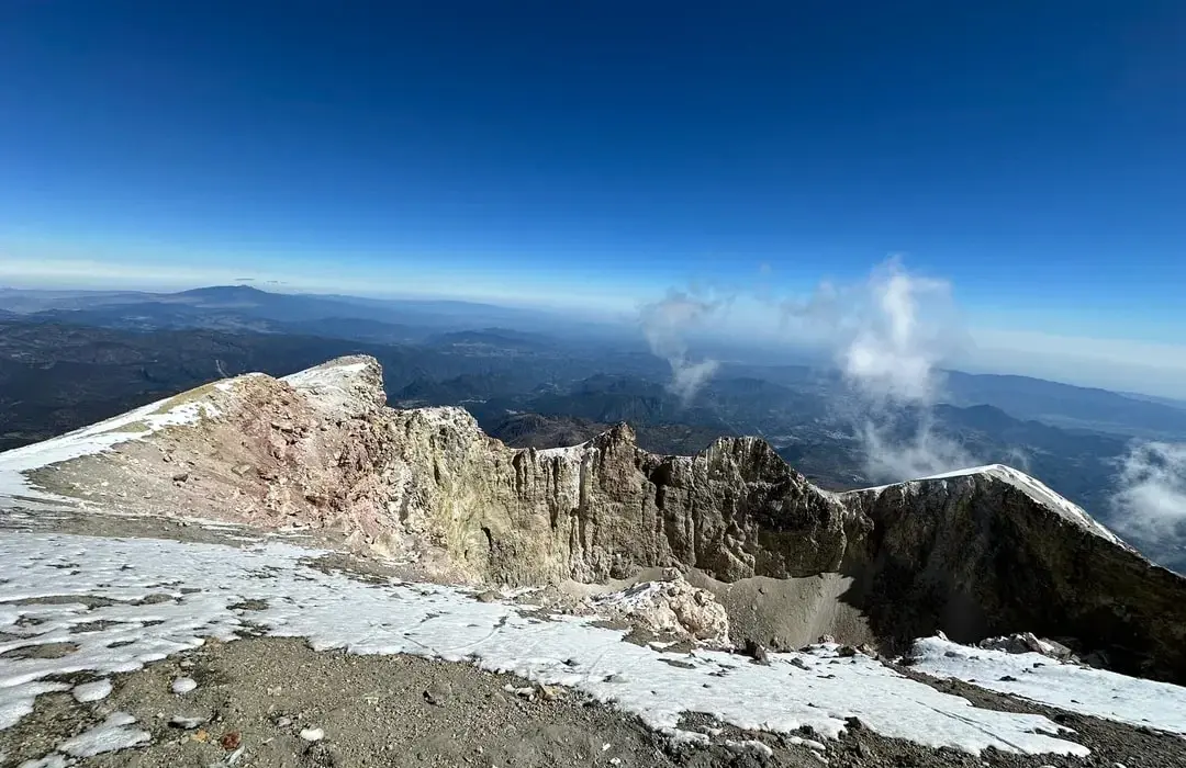
As Mexico's highest volcano, Pico de Orizaba is a stratovolcano formed through multiple eruptions over hundreds of thousands of years. Its current cone sits atop older volcanic structures, with the most recent significant eruption occurring in 1846.[1] The mountain consists primarily of andesitic and dacitic lavas, with a prominent glacier system covering its northern face. The Jamapa Glacier, the largest in Mexico, extends from the summit crater down to approximately 4,975 meters (16,322 feet) before descending to terminal elevations around 4,640–4,650 meters.[1] The volcano's crater measures roughly 500 meters in diameter and features active fumaroles, indicating ongoing volcanic activity.
Climate and Weather
Pico de Orizaba experiences a high-altitude alpine climate characterized by dramatic temperature variations. The peak maintains year-round snow and ice cover above 4,900 meters (16,000 feet), while lower elevations see temperatures ranging from -4°C to 15°C (25°F to 59°F).[1] The dry season from November to March offers the most stable climbing conditions, with clearer skies and reduced precipitation. Afternoon storms are common during the wet season (May–October), making early morning ascents advisable. Wind speeds can exceed 60 mph at the summit, and weather conditions can change rapidly, requiring climbers to be well-prepared for extreme conditions.
Human History
Known as Citlaltépetl ('Star Mountain') to the Aztecs, Pico de Orizaba held great spiritual significance in pre-Hispanic cultures. The Spanish first documented the volcano in 1519 during Cortés' expedition, and it served as a crucial landmark for ships approaching Veracruz. The first recorded summit ascent was made in 1848 by American military officers Frederick A. Maynard and William F. Raynolds.[1] In 1937, the area was designated as a national park, and it has since become Mexico's premier mountaineering destination, attracting climbers from around the world to attempt its challenging slopes.
Park History
The peak has held spiritual significance for indigenous peoples for millennia, featuring prominently in Aztec and Totonac cosmology. The first recorded ascent was made in 1848 by American military officers Frederick A. Maynard and William F. Raynolds during the American occupation of Mexico.[1] The Mexican government designated the area as a national park on January 4, 1937, to protect the unique high-altitude ecosystems and volcanic landscape, covering 19,750 hectares.[1] Throughout the 20th century, climbing tourism grew steadily, with various routes established and refuge huts constructed to support mountaineers. The park has witnessed dramatic glacier retreat since the 1960s due to climate change, with ice coverage shrinking significantly over the past five decades. Modern management focuses on balancing mountaineering access with conservation of fragile alpine environments and monitoring volcanic activity for public safety.
Major Trails and Attractions
The mountain's most distinctive feature is its symmetrical volcanic cone, crowned by a permanent ice cap and the Jamapa Glacier. The Jamapa Glacier route on the north face represents the standard climbing path to the summit, offering a challenging but accessible route for experienced mountaineers. The mountain hosts several refugios (mountain huts) including the Piedra Grande Hut at 4,270 meters (14,009 feet), which serves as the primary base camp for summit attempts.[1] The peak's prominence makes it visible from great distances, and on clear days, climbers can see both the Gulf of Mexico and the Pacific Ocean from its summit, a distance of over 300 kilometers (186 miles).
Visitor Facilities and Travel
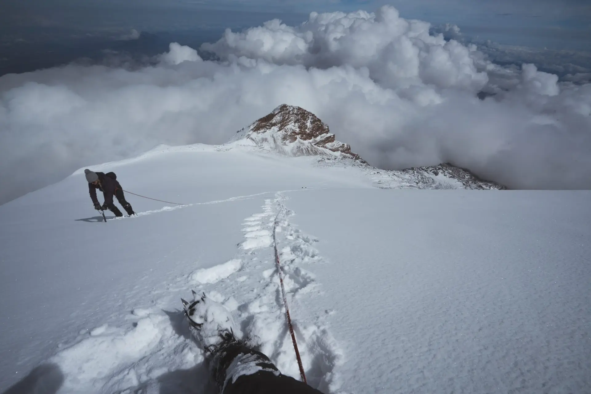
The most common approach is via Tlachichuca in Puebla, where guides and transportation to the Piedra Grande base camp at 4,270 meters can be arranged.[1] From Mexico City or Puebla City, visitors travel approximately 3–4 hours to reach Tlachichuca, then continue via four-wheel-drive vehicles on rough roads to higher elevations. The Piedra Grande hut provides basic overnight accommodation for climbers preparing for summit attempts, which typically begin at midnight to reach the summit by dawn and descend before afternoon weather deteriorates. Technical climbing equipment is not required for the normal route, but altitude acclimatization, proper clothing, and glacier travel gear including crampons and ice axes are essential. Less ambitious visitors can access lower elevations for hiking and nature observation without specialized equipment. The park is accessible year-round, though winter months bring harsher conditions, while spring offers more stable weather for climbing. All summit attempts require registration with park authorities and hiring certified guides is strongly recommended.
Conservation and Sustainability
Rapid glacier recession poses the park's most visible conservation challenge, with scientists predicting complete ice loss within decades if current climate trends continue.[1] The retreating glaciers reveal both geological features and archaeological artifacts left by indigenous peoples, requiring careful documentation before they disappear. Alpine vegetation faces pressure from both climate change and trampling by increasing numbers of climbers and hikers. Park authorities enforce strict waste management protocols requiring climbers to carry out all trash, though accumulated debris from decades of mountaineering persists in some areas. Lower-elevation forests face threats from illegal logging and agricultural encroachment along park boundaries. Water resources from the mountain's snowmelt are critical for surrounding communities, making glacier monitoring essential for regional water planning. The park participates in international glacier research programs tracking ice loss and serves as an important site for studying high-altitude ecosystem responses to climate change in the tropics.
Photos
4 photos